9 Historic Erie Neighborhoods That Vanished with Time
From the indigenous people who once roamed the land to the settlers who became shipbuilders, time has significantly changed the landscape of this lakeside city and county. Over the decades, small settlements evolved into communities, which in turn became neighborhoods that eventually merged into the municipalities we know today. To revisit our hometown’s fascinating history, Maleno took a deep dive into nine historic Erie neighborhoods that vanished with time.
Erie’s Origins: From The Mouth of Mill Creek
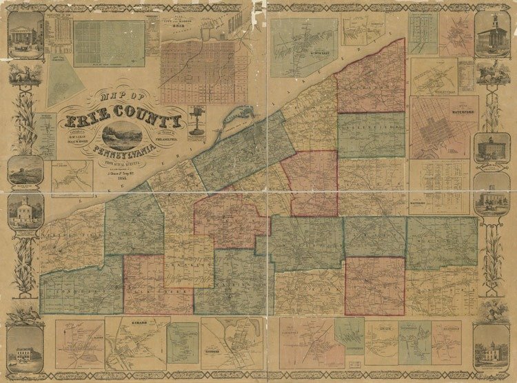
In 1795, Erie was settled by Seth Reed near the mouth of Mill Creek, and it was officially subdivided by Andrew Ellicott and William Irvine. Nearly all of Erie was centered around the mouth of Mill Creek, which ran through the city (later tunneled after the 1915 Flood) and emptied into Presque Isle Bay. Travelers would enter the city through Parade and East Sixth streets. In 1805, Erie’s General Assembly passed an act erecting this area into a borough.
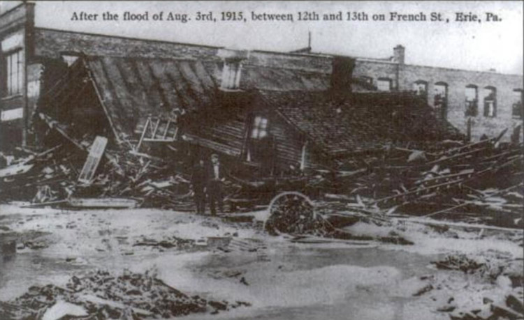 Photo Credit: Weather.gov
Over the next decade, Erie’s footprint reached State Street, where Robert Brown, a prominent Erie resident, erected a hotel and bank.
 Photo Credit: History of Erie County
From there, the once-sparse settlements around the city developed into recognizable neighborhoods, most notably:
- Cloughsburg
- Federal Hill (Eagle Village)
- Kingtown
- Marvintown
- New Jerusalem
- South Erie
- Stumptown
- Warfeltown
- Weigeltown (Weigelville)
 Photo Credit: History of Erie County
1. Cloughsburg
Now known colloquially as Erie’s Eastside, the heart of Cloughsburg was the corner of 6th and Parade Streets. The area got its name from prominent Erie resident Major Rufus Clough, a blacksmith and grocery store owner who was also a veteran of the War of 1812.
In the early 1800s, this neighborhood was popular among early settlers, as it was located on the “Old French Road,” which ran from Fort Presque Isle to Waterford. Parade Street obtained its name as it was the parade grounds of the soldiers at the fort.
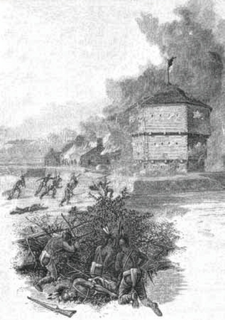
Photo Credit: Explore PA History
2. Federal Hill (Eagle Village)
The Federal Hill neighborhood, located at the summit of the hill on 26th and Peach Streets, was named by George Moore, a staunch Federalist, Erie City Justice of the Peace, and County Commissioner, due to the large numbers of Federals (those who desired a strong Federal government) who lived there.
It became a stopping point for travelers, as several public houses and stores were located at that spot. One of the hotels was the "American Eagle," from which it gained its other nickname, Eagle Village.
3. Kingtown
Erie City Mayor (1853-1854) and maltster (malt maker) Alfred King laid out a small community that ran roughly from Ash and Wayne Streets to Third and Seventh Streets in the early 1800s. The neighborhood became known as “Kingtown” and sat between what is now known as the East Bayfront and the Eastside Eagles.
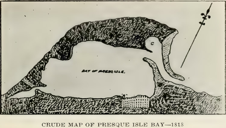
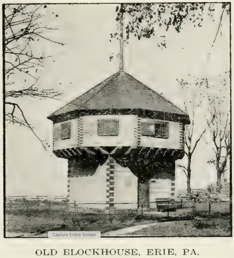 Photo Credit: History of Erie County
Fires plagued Kingtown throughout the 19th century. In 1853, the then-abandoned Mad Anthony Wayne Blockhouse was burned down by neighborhood kids. Later, in the summer of 1865, Alfred King’s own malt-house, located on the south side of Seventh Street, went up in flames.
Read More: 8 Historical Homes in Erie, Pennsylvania
4. Marvintown
In the 1800s, Marvintown was a bustling rural crossroads situated at the intersection of Wattsburg Road/Pine Avenue and Parade Street. Marvintown still exists today, as it’s still a neighborhood in central Erie.
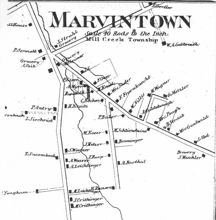
Photo Credit: Erie County (PA) Genealogy
The area was named after Captain Elihu Marvin, who owned most of the land surrounding what is now 28th and Parade Streets. The area sat at the intersection of two vital roads—Old French Road and Pine Avenue—making it a natural hub for community growth. Over time, Marvintown became home to a diverse mix of families, farms, and small businesses, including a blacksmith, grocer, and cobbler.
Much of what we know about Marvintown’s appearance and spirit comes from artist Ida Heibel, who painted the area from memory in the early 1900s. Orphaned young, Ida and her sister were raised on a farm in Marvintown and walked daily along Pine Avenue to school. In her painting and handwritten notes, she recalls a community filled with cherry and apple orchards, friendly neighbors, and a street so lush it was described as a garden.
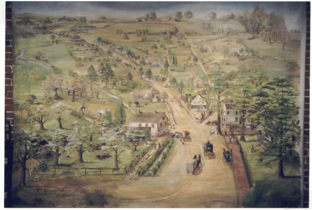 Photo Credit: Erie County (PA) Genealogy
Fun Fact: Pine Avenue got its name from a single pine tree in the yard of John Schneider, who was a prominent blacksmith.
5. New Jerusalem
What we know today as the West Bayfront, located west of Sassafras and north of Sixth Street, was known as New Jerusalem in the 1800s. This area was developed by iron industry pioneer and abolitionist William Himrod, Sr., between 1827 and 1830. To contribute to the abolitionist movement, Himrod bought the land and sold it to free black residents, with the sole condition that buyers build and occupy a house on the lot. By the mid-19th century, New Jerusalem had become an epicenter for Black culture, religion, and business.
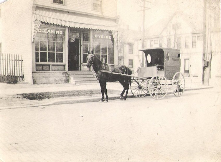 Photo Credit: History of Erie County
Himrod also used his home located at Second and French Street, called “Jericho,” as a school for black children. He named it Jericho because he said, "it was on the side of a hill," and the path from there came to be known as "the road to Jerusalem," and "the road to Jericho." His old home at Jericho later became the Erie Bethel Baptist Church.
6. South Erie
Brewer and distiller Major David McNair owned hundreds of acres in the area that would later become known as South Erie. McNair parceled off the land as it gradually grew into a thriving settlement enveloping Federal Hill.
Located between West 18th and 26th Streets from Parade to Cherry, South Erie’s growth was due to the development of the Lake Shore Railroad, which was finished to Erie on January 10, 1852. When the railroad was built and physically drew a dividing line between North and South Erie, the area developed a character and name of its own, and was incorporated into a borough organization in 1866, before becoming part of the City of Erie in 1870.
South Erie was home to a well-known and well-patronized hotel, called the "South Erie Hotel," built at Peach and Twenty-sixth streets by Nathan McCammons in the winter of 1817-1818. In the “boom days” of 1837, this property sold for $17,500.
7. Stumptown
On the edge of New Jerusalem, between Peach and Sassafras Streets at the mouth of Lee’s Run, ship workers established another community known as “Stumptown.” If you’re unfamiliar with “Lee’s Run,” it’s because the creek disappeared from local maps when Erie businessman Rufus Reed and his son Charles used the creek-bed as the route for the Erie Extension Canal, connecting Erie with Pittsburgh in 1844.
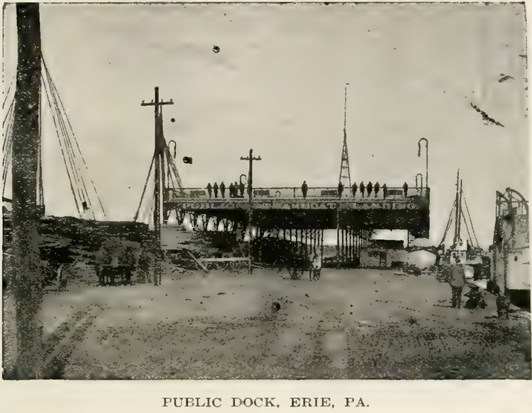 Photo Credit: History of Erie County
The people in this area were largely responsible for building Oliver Hazard Perry’s fleet, most notably the Tigress and Porcupine ships. The tree stumps left behind after lumber was cut for ships and cabins were what gave this area its name.
8. Warfeltown
The Martin Warfel farm was situated on 130 acres, bounded by Buffalo Street (18th) and Water Street/Arbuckle Road (28th Street), and extending from the present-day East Avenue to Elm Street. The farm was originally part of Millcreek Township, which later became incorporated into the City of Erie. Martin Warfel, from whom Warfeltown gets its name, was employed by Swalley & Warfel, a company with a large factory on Peach Street that produced laundry and other soaps in the mid-1800s.
At one time, a massive Native American burial ground was located on the edge of Warfeltown, just east of East Avenue. This burial ground of the Eriez Indians became a popular site for schoolchildren and other researchers to search for skulls and other human remains.
A Spooky Sidebar
Many burial mounds were eventually found around Warfeltown. According to John Elmer Reed's History of Erie County, a “very large” human skeleton was found near Warfeltown, along with two copper bowls that had been perforated around their edges and held together with a buckskin thong laced through and out of these perforations. The bowls held about a pint of beads each. No one knows what happened to the bowls, beads, or body.
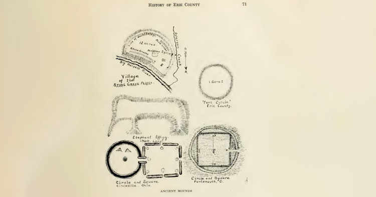
Just south of Wesley ville, now Wesleyville, searchers found burial mounds with several human skeletons in a sitting posture facing east. Reed writes:
Numerous drinking vessels were found accompanying them. Other graves in the vicinity had similar contents, all facing the east. A large mound near the New York Central R. R. tracks in North East township, about three miles east of the borough of North East, was opened many years ago by Dr. Heard, a prominent physician and surgeon of that place, and several skeletons uncovered, all with the feet pointed towards the center as in the spokes of a wheel.
Other small mounds were also found in McKean township, south of the Buffalo Road, and in the middle of a field just west of Fredonia, N.Y.
In 1825, one of the most notable finds was made by a farmer while plowing a field in Harborcreek Township. It was a strange-looking bead, which he cleaned and preserved, and which later fell into the hands of L. G. Olmstead, a law professor and archaeologist. It is thought to be a "Chorean Bead," used in Egyptian religious ceremonies. It is said there are only about 30 of those famous beads in existence. Some historians believe that Erie County was once a highly populated area inhabited by humans who may have communicated with people from Europe and beyond.
What’s more, the skeletons of extinct species of animals have frequently been found in Erie County. For instance, in 1880, a man discovered bones of a mammoth in Girard. This mammoth was thought to be fifteen feet long and twelve and a half feet tall.
One of the teeth weighed three and a half pounds and had a surface of three and a half by four inches. A piece of preserved tusk also led researchers to believe the complete tusk would have been eight or ten feet long.
9. Weigeltown (Weigelville)
The main thoroughfares in Erie were frequented by farmers and “drovers” bringing their cattle and animals to market. Great herds of cattle, sheep, and horses were always passing along the leading highroads, and when night hit, the taverns and droveyards along the way afforded accommodation for travelers and their animals, or as the signs would often say, “For man and beast."
German pioneer George Weigel, Sr., purchased 50 acres of land in 1833 in the area of the current-day West 26th Street and Brown Avenue. A hotel, known as the Weigelville House, was located there, and became a popular stagecoach station and stopping place for travelers before the final mile-and-a-half stretch to the City of Erie. On arrival, the herd was usually driven into the drove-yard and the drivers put up at the tavern, sometimes three or more in one bed.
A Small Part of Erie’s History
Today, these forgotten neighborhoods live on not in street signs or city maps, but in Erie’s rich history. Though names like Cloughsburg, Warfeltown, and New Jerusalem have faded from modern-day Erie, their stories continue to shape our understanding of the city and county’s roots and the people who built it.
While we’re certainly a newer part of Erie’s history, Maleno has built over 1,000 homes in the Erie region since 1976, developing new communities and neighborhoods that let people call this lakeside city and county home. If you’re interested in buying or building a home in this beautiful lakeside city, contact a Maleno agent today.